Showing posts with label Carnac. Show all posts

Apr 10, 2016

Géant de Manio / Quadrilatère de Manio - Carnac (France)

Along the stone rows of Carnac to the east the "Quadrilatère de Manio" and the "Géant de Manio" are to be found.
Both are dated to the neolithical age of about 4.500 B.C. and were discovered at the beginning of the 20th century.

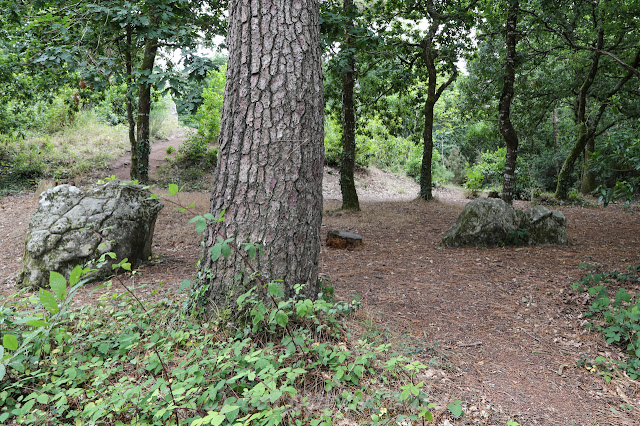
The quadrilateral enclosure of local granite stones have a height of max. 1 meter. The length of the site is about 37 meters, the eastern width is app. 10 meters but western width app. 7 meters. It was supposed to be a surrounding of a flattened tumulus.  

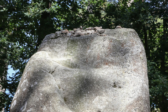
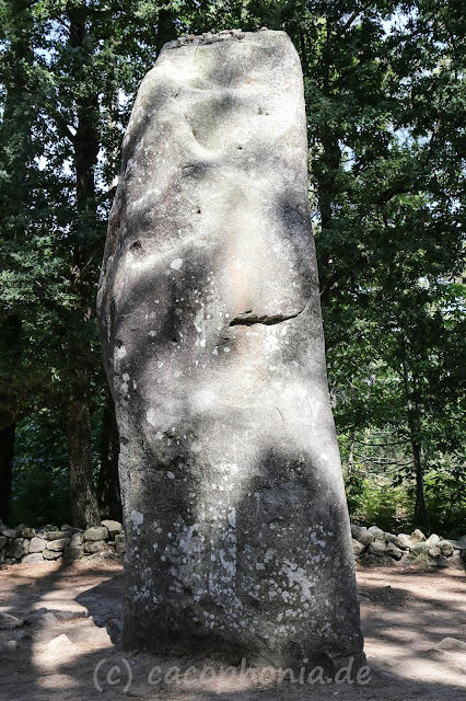
"Géant de Manio", the menhir next to the Quadrilatère, has a height of app. 6,5 meters. A legend says: If you throw a pebble onto the top of the menhir AND it remains on it, you have a free wish ...

Quadrilatère de Manio

Menhir Géant de Manio
Stones on top of the Géant


Mar 15, 2016

Tumulus St. Michel - Carnac (France)

From a distance the Tumulus of St. Michel looks like a huge hill but it is one of the biggest grave hills in Europe and situated in the east of Carnac. The Tumulus has dimensions of 125m length, 60m width and 10m height. Inside the Tumulus is a closed chamber where burnt human bones were found. In the 13 stone cists around this chamber furthermore remains of burnt animals bones, axes, pendants were found.
Unfortunately it is not possible to have a look into the Tumulus.
  
During the 17th century the chapel was built on the hill. There is also a christian cross next to it. Its erection dates back to the 16th century.
  
Geographic coordinates: 47° 35′ 17″ N, 3° 4′ 25″ W

side entrance (closed) to the Tumulus


Menhir, back entrance (closed) and stairway to the top of the Tumulus


Christian cross and overview to the west from the top of the Tumulus
Christian cross, chapel and overview to the east
Cross with crucifixion


Mar 14, 2016

Tumulus de Kercado - Carnac (France)

As one of Europes oldest megalithic sights the Tumulus of Kercado is situated in the woods of Carnac south of Kermario. It is dated to 4.500 BC.
In former times the Tumulus was surrounded by a Cromlech. Nowadays you can find only a few Menhirs / stones. The Menhir on the top of the Tumulus was set there by its second excavator R. Galles at the beginning of the 20th century.

The hill has a diameter of app. 40 metres. Chamber (3,2m x 2,2m) and corridor consist of 17 stones while there are 5 endstones for the corridor and 1 endstone for the chamber. You will find some carvings in the stones. So it is necessary to take a torch with you.
In the chamber and the corridor some grave goods such as axes, arrowheads and pearls have been found.

Geographic coordinates: 47° 35' 45" N, 3° 3' 14" W


Menhir of the former Cromlech around the Tumulus in front of the entrance

Entrance of the Tumulus with Menhir on the top

some remaining Menhirs around the Tumulus

some remaining Menhirs around the Tumulus


Jan 23, 2016

Carnac Stones - Carnac (France)

The best known megaliths of south Brittany are the Carnac Stones. With a length of app. 4 km (original length 8 km) they consist of alignments, dolmens, tumuli and menhirs. With more than 3000 stones (original 4000) the Carnac Stones are the largest collection worldwide.

The alignments parts in three areas which build rows: Ménec alignments (western part), Kermario alignments (middle), Kérlescan and Petit-Ménec (eastern parts). 

In Ménec is a visitor's centre with information about the megaliths and a shop. From the roof-deck you can have a little view to the alignments of Ménec. At the parking area next to the visitor's centre they offer bus tours along the alignments with explanations in different languages.

The stone rows are enclosed, so it is not possible to walk through - only around the area. Maybe you can join a guided tour. Starting with a walk to the western stones of Ménec which are situated in the village near houses the view to the rows is indescribably impressive.

The first part of alignments is parted by a street. An abandoned house shows how people lived surrounded by the ancient megaliths. Along the street in Kermario there is a small dolmen beside the stones. On a small hill you can climb a look-out with a view the western and eastern stones.

Geographic coordinates: 47° 35′ 5″ N, 3° 4′ 40″ W

Alignments of Ménec


Alignments of Kermario


Alignments in the village Le Ménec